
The Bottom Line
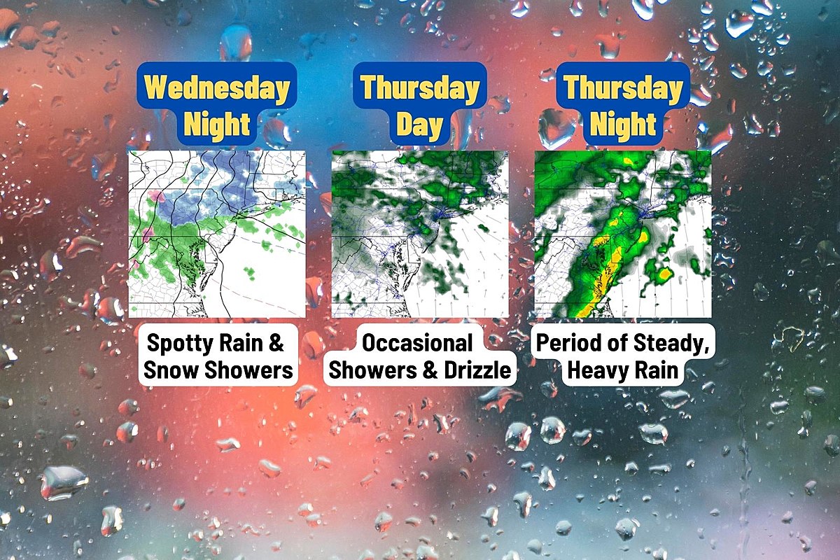
There is only one stumbling block in New Jersey’s weather forecast: An area of low pressure that will track overhead from Thursday into Friday. The forecast hasn’t changed much, as warm air forces a wet (not wintry) situation. But there are some nuances here, as the system plays out in approximately three parts.
1.) Getting started: Spotty showers and fog Wednesday night. Conversational snowflakes are possible, briefly, to the north.
2.) A blah day: Occasional showers and drizzle during the day Thursday.
3.) The brunt of the storm: A period of steady, heavy rain Thursday night through early Friday morning.
We will then dry out, clear out, and cool down again on Friday. That will set us up for a quiet, sunny, and seasonably chilly January weekend.
Wednesday
The cloud cover broke apart a bit overnight. And where that happened —especially to the south and west — temperatures have crashed into the 20s. A colder-than-expected start to the day there. Closer to the coast and NYC, we are in the 30s.
You will catch peeks of sunshine early on Wednesday, before clouds take over the sky once again through the afternoon. The air is still bone dry. Winds will stay light. And temperatures will be seasonably cool, peaking in the lower 40s.
Wednesday Night
As low pressure slowly approaches from the west, the outer bands of precipitation may spark a few showers and sprinkles over New Jersey. …